Request for Proposal
Eagle River Coalition (ERC) is requesting proposals from qualified consultants for environmental and engineering planning and design for the Lower Eagle River Riparian Restoration Project in coordination with the Bureau of Land Management, Silt Office.
Proposals must be submitted in digital format via email to Peder Franson at franson@eagleriverco.org on or before 5:00 PM MDT, Friday, August 16, 2024.
If you have any questions or would like further clarification of any aspect of this request for bid, please contact Peder Franson at franson@eagleriverco.org by 5:00 PM MDT, Friday August 2. Responses to all questions submitted by consultants will be distributed by email to all parties and are available here.
| Schedule | Deadline |
| Issue Request for Proposal | July 22, 2024 |
| Questions/clarifications about RFP due | 5:00 PM MDT, August 2, 2024 |
| Responses to questions emailed to all parties and available here. | 5:00 PM MDT, August 9, 2024 |
| Proposals Due | 5:00 PM MDT, August 16, 2024 |
| Select Consultant | August 19 – August 23, 2024 |
| Finalize Contract/Issue Notice of Award | August 26 – August 30, 2024 |
Lower Eagle River Riparian Restoration Project Background
The project goal is to improve the riparian and aquatic habitat resiliency of the lower Eagle River, in Eagle County, Colorado. This will be achieved by re-establishing floodplain connectivity, improving in-channel fish habitat and engaging the community in understanding the importance of watershed restoration. Additionally, the project will look to establish and enhance sustainable river recreation access.
An early assessment of the lower Eagle River by the project partners and stakeholders, including the Eagle River Coalition, Bureau of Land Management (BLM), Colorado Parks & Wildlife (CPW) and a water engineer, identified the project location and its contributions to water quality and quantity issues and lack of proper wildlife habitat. Throughout most of the project reach, which lies from the eastern BLM property boundary near the Gypsum campground to the BLM property boundary downstream, the floodplain has become disconnected from the river. The project’s objectives, to reconnect the floodplain and improve in-channel habitat, will provide habitat for native wildlife and fish species to thrive, will improve water quality and quantity and can help mitigate the effects of climate change.
Background of the Eagle River Coalition
Eagle River Coalition (Formerly Eagle River Coalition has a mission to advocate for the health of the Upper Colorado and Eagle River basins through research, projects, and education. The Coalition strives to protect and enhance the high-quality natural, scenic, and economic values that our rivers and tributaries provide to the citizens, visitors, and wildlife of the Eagle River and Colorado River watersheds located in Eagle County.
Our organization has been working to achieve our mission since 1992, and has direct ties to the Eagle River Environmental Business Alliance which sought to improve water quality and river experiences following the Eagle Mine Spill in the late 1980s. Since then, we have achieved measurable progress in water quality throughout the watershed and grown as an organization to better serve our community.
Scope of Services & Deliverables
Task #1: Additional Data Collection & Interpretation
Completed by: December 2024
- Conduct site visits to determine current floodplain, aquatic habitat, riparian and stream function and other watershed-specific reference data that will be used to inform
- Work with identified project partners, including Eagle County, Colorado Parks and Wildlife and Trout Unlimited, to collect additional data, as needed.
- Analyze and interpret data as needed to inform Task #2.
Task #2: Natural Channel Design
60% Design Completed by: December 2024
100% Design Completed by December 2025
- Using data interpreted from Task #1, develop a natural channel design that meets the following objectives:
- Improve riparian habitat and floodplain
a. Reconnect the floodplain at strategic locations in the 2-mile reach from the eastern BLM property boundary near the Gypsum campground to the BLM property boundary downstream.
b. Improve cottonwood and riparian vegetation recruitment by reconnecting the floodplain and through revegetation planting projects.
- Improve natural infrastructure to buffer against damage caused by wildfire and flooding events.
a. Lower and reconnect the floodplain to discourage intense wildfire and support recovery following fire events.
b. Protect against excessive erosion during flood events by allowing the reconnected floodplain to dissipate the energy of high water - Improve in-stream fish habitat
a. Reduce the width/depth ratio at strategic locations within the 2-mile reach
b. Increase fish habitat complexity
Task #3: Provide Environmental Planning services to develop “NEPA ready” proposed action(s)
Completed by: July 2025
- Work with BLM staff to create Purpose & Need document
- Using the concept designs created in Task 2, work with WRNF staff to identify and conduct appropriate data and resource-level field surveys to develop the plan and allow the project to be “NEPA ready”. Will include cultural and wildlife, may include botany, streams/wetlands, etc.
- Provide cultural resources support to ensure State Historic Preservation Office (SHPO) compliance.
Task #4: Provide 3rd party National Environmental Policy Act (NEPA) environmental analysis, support, compliance, and permitting
Completed by: December 2025
At this time, we are unsure if this project will require an Environmental Assessment (EA) or an Environmental Impact Statement (EIS). However, we believe no EIS will be triggered since we expect the proposed actions will not have significant long term environmental effects that can’t be mitigated.
We would like to complete NEPA by the end of Dec. 2025, but we understand this timeline will be mainly dictated by the level of NEPA required.
- Complete any additional fieldwork not completed during the development of the proposed action.
- Collaborate with BLM resource specialty staff on the NEPA process as needed.
- Collaborate with the stakeholder facilitator facilitator to ensure the Stakeholder Group is engaged at key milestones during the NEPA process.
- Prepare necessary reports, data reviews, and other documents for S. Army Corps of Engineers 404 permits to work within the stream, if necessary, based on the alternative chosen through either the Finding of No Significant Impact (FONSI) or Record of Decision (ROD)
Contents of Proposals
Responses to the RFP should include a description of the following:
- Understanding the Work. Demonstrate an understanding of the work and present an overall summary of what the Consultant determines is necessary to accomplish the goals of the project
- Project Description of how the firm plans to complete these services (i.e. the approach), including any recommended changes or additions to the Scope of Services above. Provide any proposed strategies based on additional insight, capabilities, or perspectives of the Consultant. Clearly describe how the proposed Project Approach meets the goals of the project.
- Project Team. Propose a project team including Consultant staff and subconsultant(s). Include resumes for individuals from all associated consultant(s) and any additional subconsultants. The resumes should emphasize recent experience of the project team and should include the following information:a. Geographic location of the office to which the individual is normally assigned
b. Proposed responsibility and function on the team
c. Estimated percent of time and duration assigned to this project
d. Background, relevant experience, and education
- Anticipated Schedule. The work is anticipated to start by August 2024 and is envisioned to be completed by December 2026. However, the NEPA permitting process will inform the Though we have provided a preferred schedule for task completion outlined above, we will consider adjusting this timeline, per the recommendation of the BLM -Silt Office and the Consultant. To this end, we request that the Consultant submit a project schedule for consideration illustrating when each task will be accomplished.
- Estimated Costs. Although the selection of a consultant will not be wholly based on cost, an estimate of costs for each task in the Consultant’s Scope of Work must be included. For task 4, please include a base price and then a price option for an EA and a price option for an EIS, as at this time we are unsure which level of NEPA will be required. This cost estimate, at minimum, shows the hourly rate of all team members, the estimated hours by task for each member, subconsultants costs by task, and other direct costs including proposed markups.
- Consultant Qualifications. This section of the proposal should summarize the recent experience of the Consultant in performing related A maximum of five projects, completed within the last five years, may be included. For each related project, please include the following information:
a. Name of client
b. Name and current contact information of primary client
c. Date pertinent work was
d. Specific role of the firm on this
e. Initial Consultant contract amount and initial completion
f. Final Consultant contract amount and final completion
g. Involvement of staff proposed for Eagle River Coalition’s project.
Information on projects completed by the firm that did not actively involve members of the proposed project team should be minimized. The above clients will be considered references by Eagle River Coalition that may be checked for finalists of this project.
- Project Management Plan. The Consultant shall provide a brief project management plan for the The plan shall demonstrate the following:
- Scope, progress measurement, and reporting
- Schedule measurement and reporting
- Staff and subconsultant team management
Submissions must be in one, single electronic file (PDF) and is not to exceed 15 pages. Individual resumes are limited to two pages and are not included in the 15-page limit.
Selection Procedure
Proposals will be reviewed and evaluated by Eagle River Coalition staff and board. This will be a selection process designated to identify the “best fit’ of Eagle River Coalition and the Consultant, taking into consideration a variety of criteria including, but not limited to, the following:
- Qualifications and experience (1 – 25 points)
- Project team (1 – 10 points)
- Project approach (1 – 20 points)
- Ability to meet project schedule (1 – 5 points)
- Past project references (references may be contacted during the review process) (1 – 10 points)
- Quality of proposal (1 – 10 points)
- Consultant fee (1 – 10 points)
Appendix A: Field Visit Results
Overview:
On September 7th, 2022 ERC and BLM Staff floated approximately three miles of the Eagle River from just below Gypsum Campground to Duck Pond. This reach of the river was previously identified for potential restoration opportunities. We floated as a group to assess whether we cumulatively thought there were opportunities for improvement. This section of river comprises Bureau of Land Management land, private, and land managed by Eagle County. Restoration of this entire reach would require collaboration between the BLM, ERWC, private landowners, and Eagle County.
The following issues were identified that could be remediated through restoration efforts:
- Lack of fish habitat complexity
- Loss of floodplain connectivity throughout most of the reach
- Lack of recruitment of cottonwood trees
- Over widening of channel in places (i.e., increased width/depth ratios)
- Lack of sinuosity in middle section of reach
- High angling pressure in upper part of reach
Goals of restoration would include:
- Increase fish habitat complexity
- Re-connect the river with its floodplain
- Increase recruitment of cottonwood by re-connecting the river with its floodplain
- Reduce width/depth ratios in sections
- Potentially increase sinuosity in middle section of reach
- Increased fish habitat would spread out angling pressure along the lower Eagle River
Appendix B: Site Photos
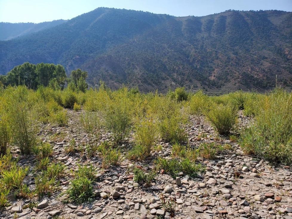
Figure 1 – Point bar just downstream of where we put in (39.650733, -106.988844). This point bar has good floodplain connectivity along with cottonwood and willow recruitment. Several age classes of cottonwood present. This is what we would like to replicate on point bars and floodplains downstream.
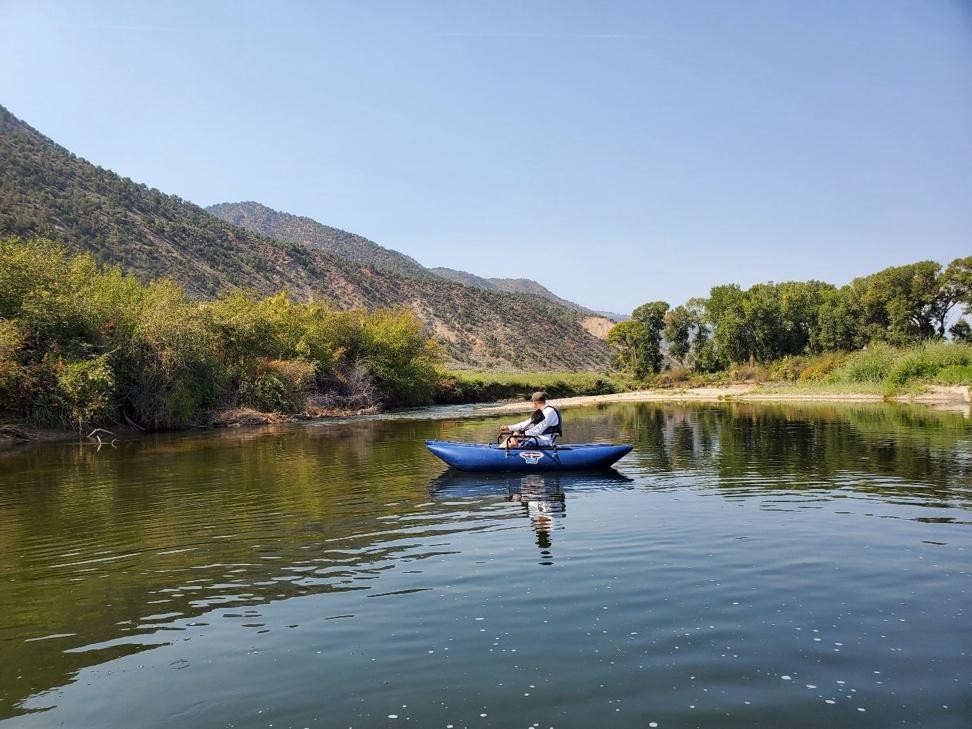
Figure 2 – This photo was taken looking downstream (39.648597, -106.989556). Over widened section of channel with lack of floodplain connectivity on both left and right banks. Note large side bar formation on river right downstream.
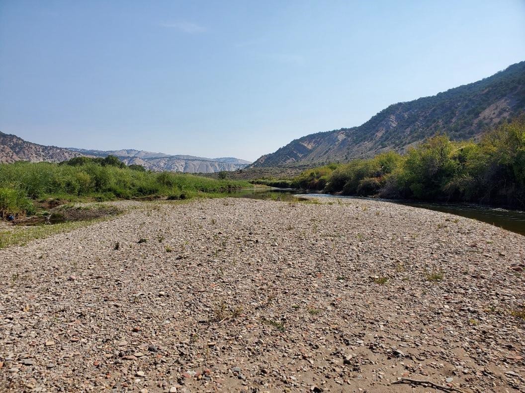
Figure 3 – This photo was taken looking upstream (39.648664, -106.990542). This is the large side bar referenced in Figure 2. This is looking upstream. Just upstream of side bar, high banks dominate both sides of the channel with lack of floodplain connectivity.
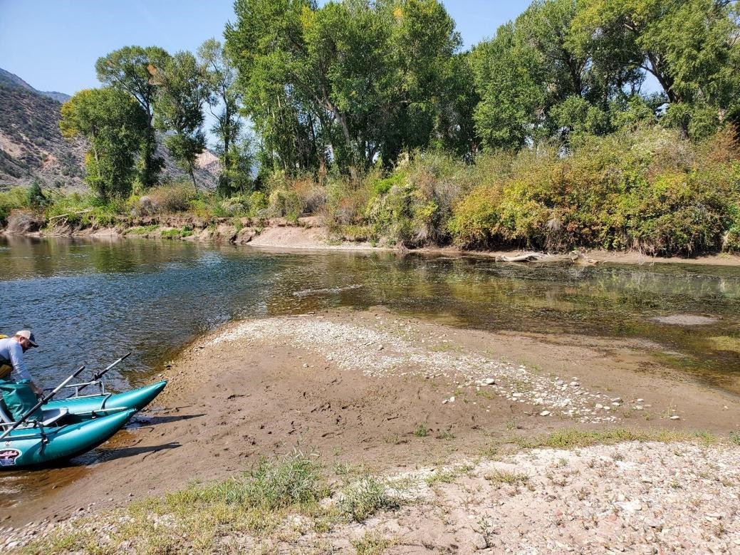
Figure 4 – Downstream end of large side bar (39.648589, -106.991042). Backwater habitat present on right side of channel. Several schools of fingerling trout present in backwater. Severe erosion on right bank just downstream of side bar. It appears that there may be a chute cutoff forming on right side of bar, potentially increasing erosion on outside right bank.
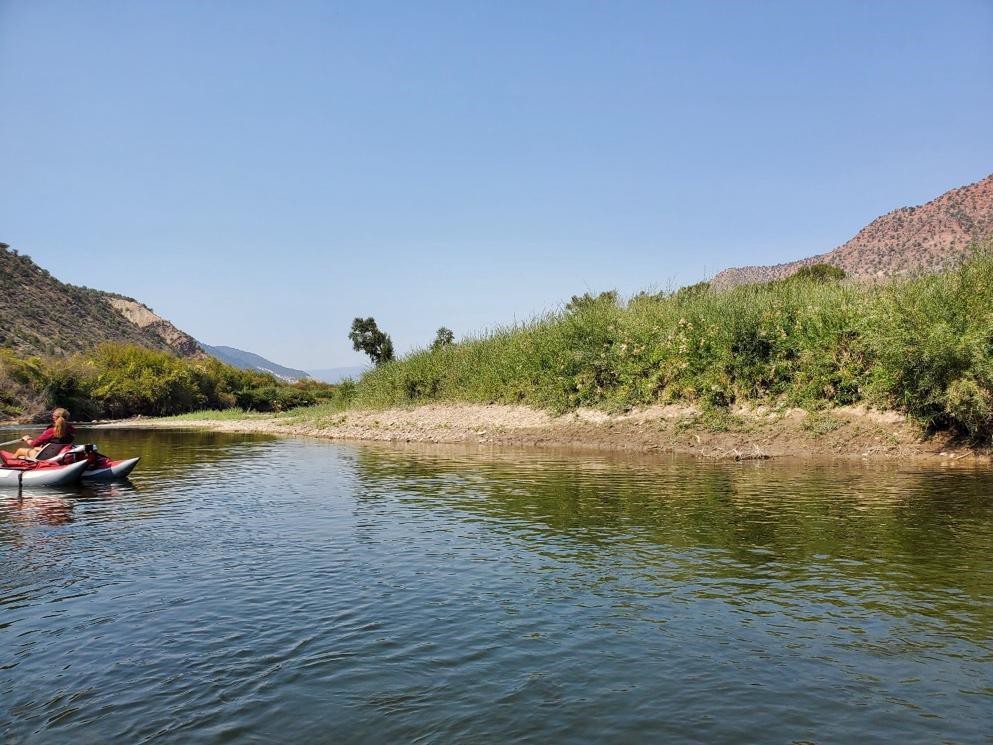
Figure 5 – This photo was taken looking downstream (39.647344, -106.992122). Beginning of point bar feature on tight meander bend. There is potential on this right bank to increase floodplain connectivity and increase recruitment of cottonwood.
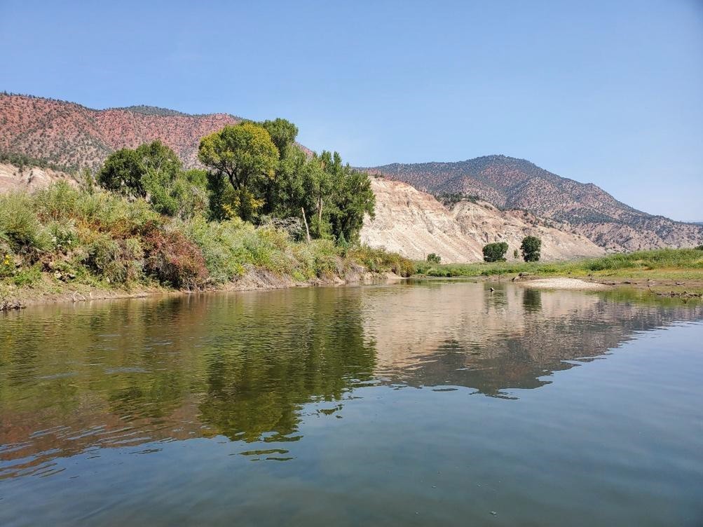
Figure 6 – This photo was taken looking upstream (39.647431, -106.997472). Overwidened and straight section of channel with a homogenous streambed. Except for backwater on river left, high banks above the bankfull elevation dominate left and right banks. This section could potentially use some increased sinuosity. Reducing width/depth ratios in this section and lowering the banks to increase floodplain connectivity would be a primary goal in this section. This is the downstream extent of mature cottonwoods. No young age classes of cottonwoods were seen. This is just downstream of the BLM boundary.
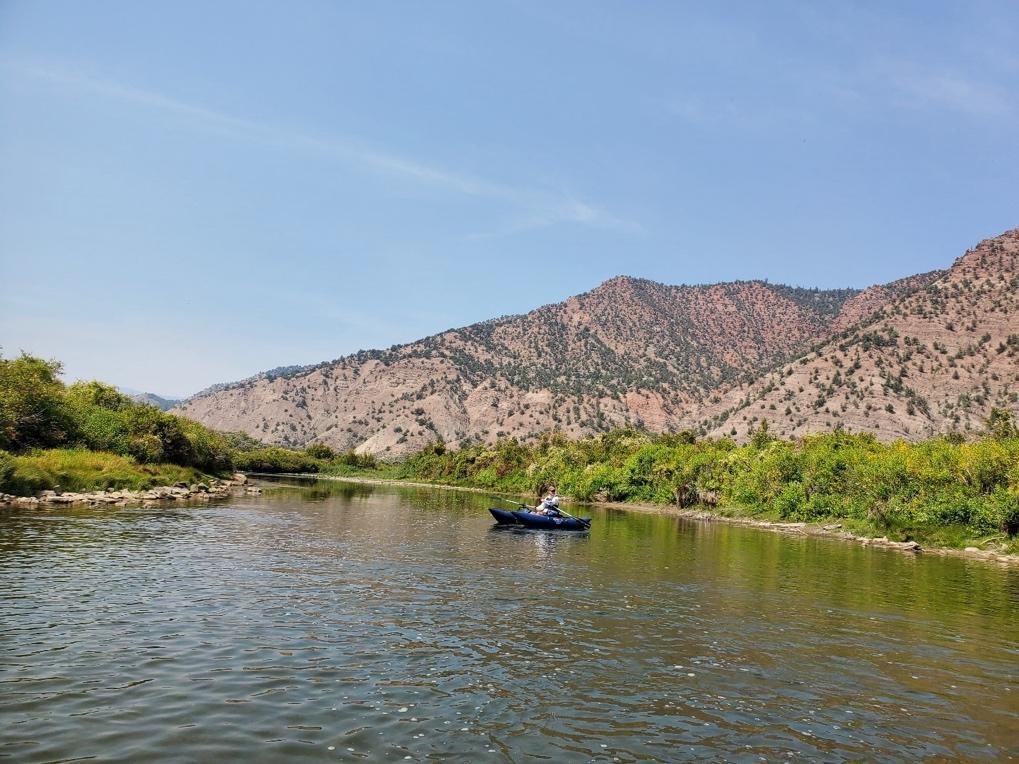
Figure 7 – This photo was taken looking downstream in same section as Figure 6 (39.647431, -106.997472). Except for backwater on river left, high banks above the bankfull elevation dominate left and right banks. This section could potentially use some increased sinuosity. Reducing width/depth ratios in this section and lowering the banks to increase floodplain connectivity would be a primary goal in this section. This is the downstream extent of mature cottonwoods. No young age classes of cottonwoods were seen. This is just downstream of the BLM boundary.
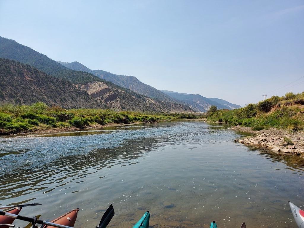
Figure 8 – This photo was taken looking downstream (39.647186, -106.999414). This is still in the straight section of reach. There is a lack of floodplain connectivity in this section. Note that cottonwoods are no longer present. This is just downstream of the BLM boundary.
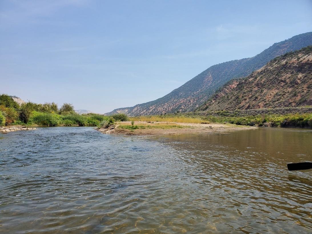
Figure 9 – This photo was taken looking upstream (39.646153, -107.003453). This is on BLM just downstream of the private stretch. The river changes to Eagle County just downstream of this section. Over widened section with mid-channel bar formation and lack of streambed heterogeneity. Lack of floodplain connectivity in this section as well, as top of banks are above the bankfull elevation.